Overview
Langtang Valley Trek is the nearest and shortest high‑Himalayan journey that delivers 360° close-up views of 19+ peaks of Nepal and Tibet side, something other short treks just can’t match. Nepal’s first Himalayan national park protects this entire region. Getting to the trailhead takes a 6-8-hour drive. No expensive flights to reach the trailhead. Hike to Tserko RI (5033m), rewards with 19+ mystical 7000-8000m+ high Himalayas in a single slow turn. Mountain ranges extend north into Tibet, with views of both the Nepal and Tibet side mountains. Brown plateau meeting white peaks at the border. You see dozens of other high Himalayas, which don’t have names.
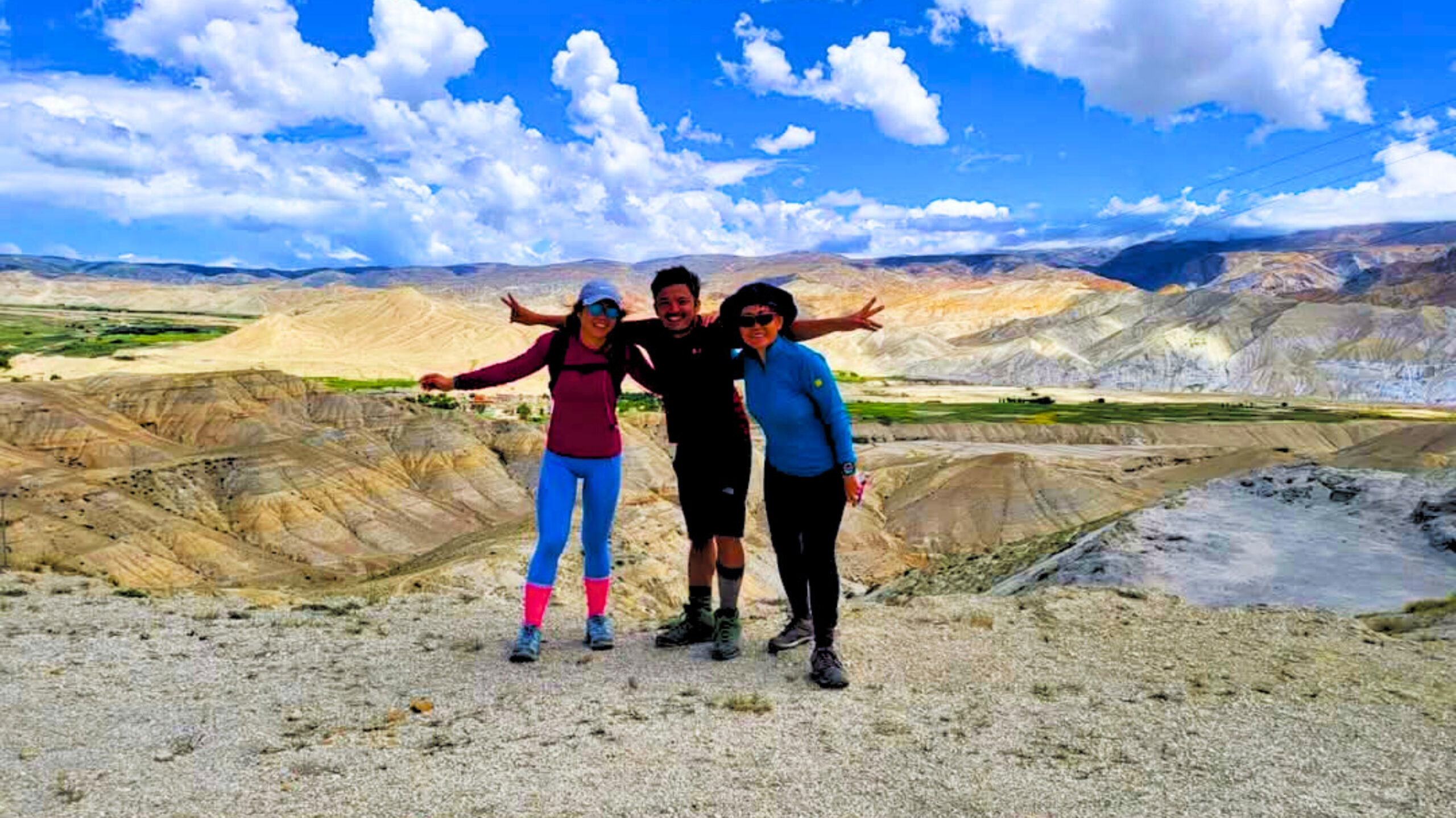
Somehow Langtang Valley trek stays underrated. Everyone chases Everest Base Camp or Annapurna Circuit, while Langtang sits right there, practically touching the capital, delivering billion-dollar views that rival any famous route in the world. The crowds are fewer than at ABC or EBC, where genuine Himalayan culture is still intact. The landscape changes from dense forest to alpine scrub to glacial moraine in maybe four walking days. Few treks anywhere compress this much vertical variety into such a short distance. Raw and ancient Himalayas of 7000-8000m+ [;[]mountains surround you from every direction.
The Tamang people living here maintain Buddhist traditions that their ancestors practiced for centuries. Their Buddhist culture colors everything here. Other treks show you mountains from a distance. Langtang puts you right under them. This short, high Himalayan trek is short enough for tight schedules and long enough to feel like a genuine Himalayan adventure. The valley runs north toward Tibet. This beginner-friendly trek is perfect for those who don’t have enough time, for families with children, and older people.
Mountains fill your vision rather than sitting on distant horizons in the Langtang Valley Trek. On exceptional mornings, the view stretches west toward Ganesh Himal. East toward Jugal Himal and north toward Tibet. The Himalayan chain spreads in both directions. The U-shape glacial profile gives it away. This entire valley was carved by glaciers and the high Himalayas over thousands of years. Langtang Valley trek feels like entering to different dimension of the high Himalayas.
On your Langtang Valley Trek, you walk beneath some of the highest Himalayan peaks of the entire world. Langtang Lirung (7,227m) dominates the lower to upper trail. Dorje Lakpa (6,966 m) sits southeast of the Langtang Valley. Gangchempo (6,387m) sits east of Kyanjin. Naya Kangri (5,844m) guards the pass leading toward the Helambu region. Shishapangma (8,027m), this Tibetan giant sits on the northern side, followed by its neighbors of the Langtang Himalayas.
Trip Highlights
- Shortest and closest high Himalayan trek from Kathmandu.
- Trailhead is 6-8 hours from Kathmandu, no costly flights and no long drives.
- Climb to Tserko Ri (4,984 m), with 360-degree views of more than 20 high Himalayas of 6000-7000m+.
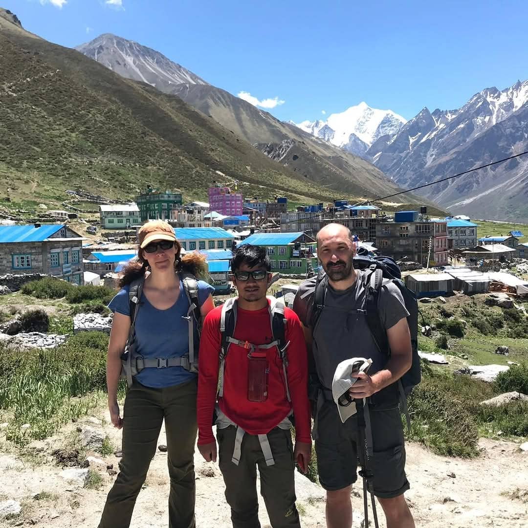
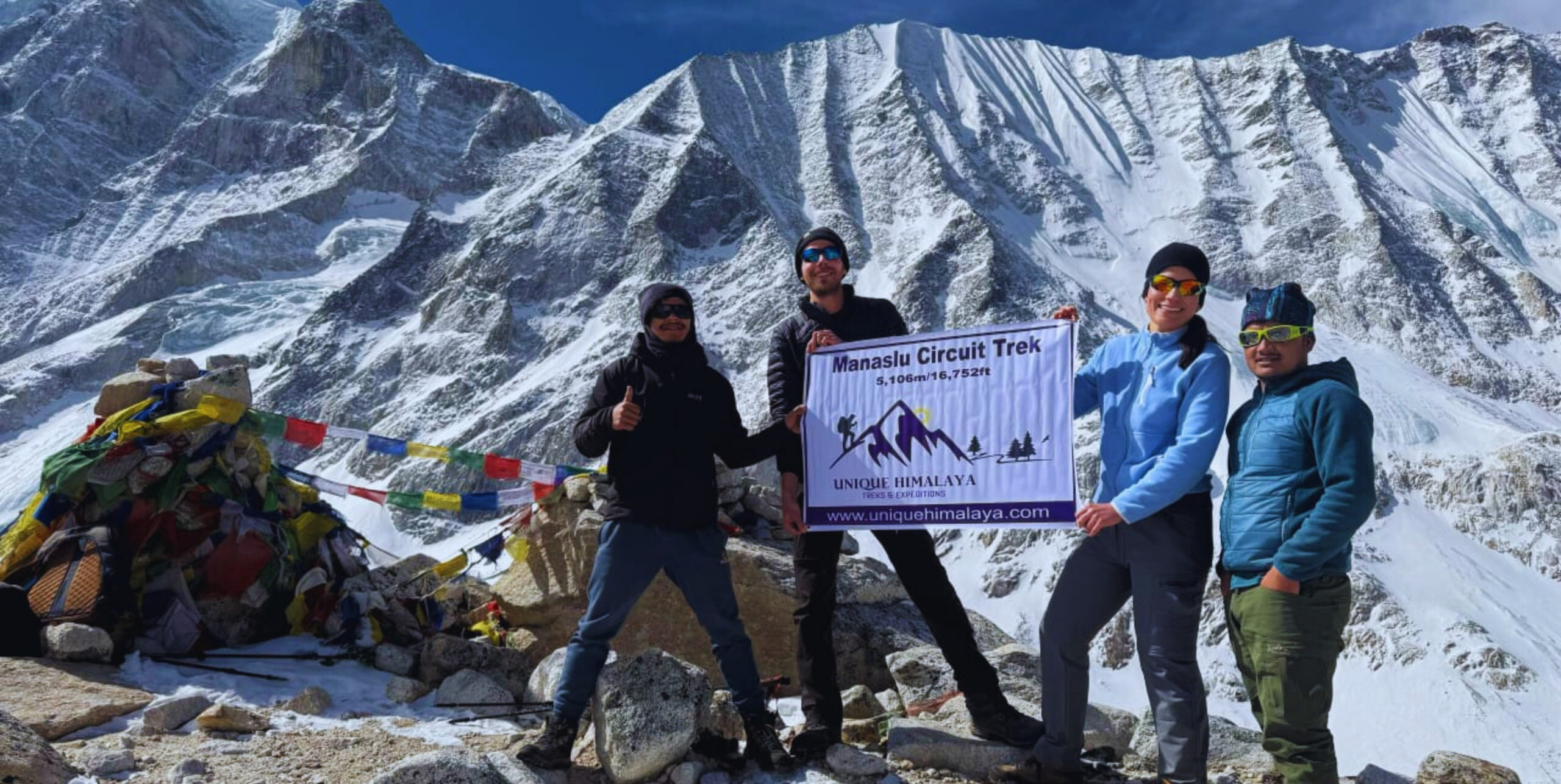
- Overnigh at traditional Tamang teahouse and experience local Himalayan culture.
- Stay in the ancient spiritual heart of the Langtang valley, Kyanjin Gompa (3,870m).
- Try local Himalayan cheese at the factory that operates at Kyanjin Gompa, 3,870 meters above sea level. Swiss experts helped set it up in 1955.
- Check out the living history, Langtang village, which was rebuilt newly with higher frequencies of raw energy all around you.
- Explore glacial moraines surrounded by a ring of Himalayan giants where ice once covered everything. The Langtang glacier has retreated dramatically. The boulders and debris it left behind create an otherworldly landscape. Walking across these ancient deposits feels like crossing another planet.
.
Essential Info
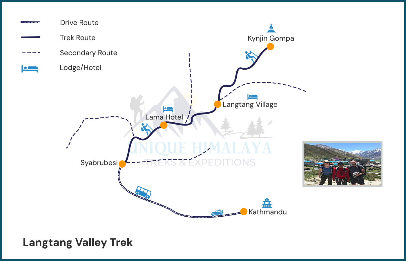
Trails of Langtang Valley Trek
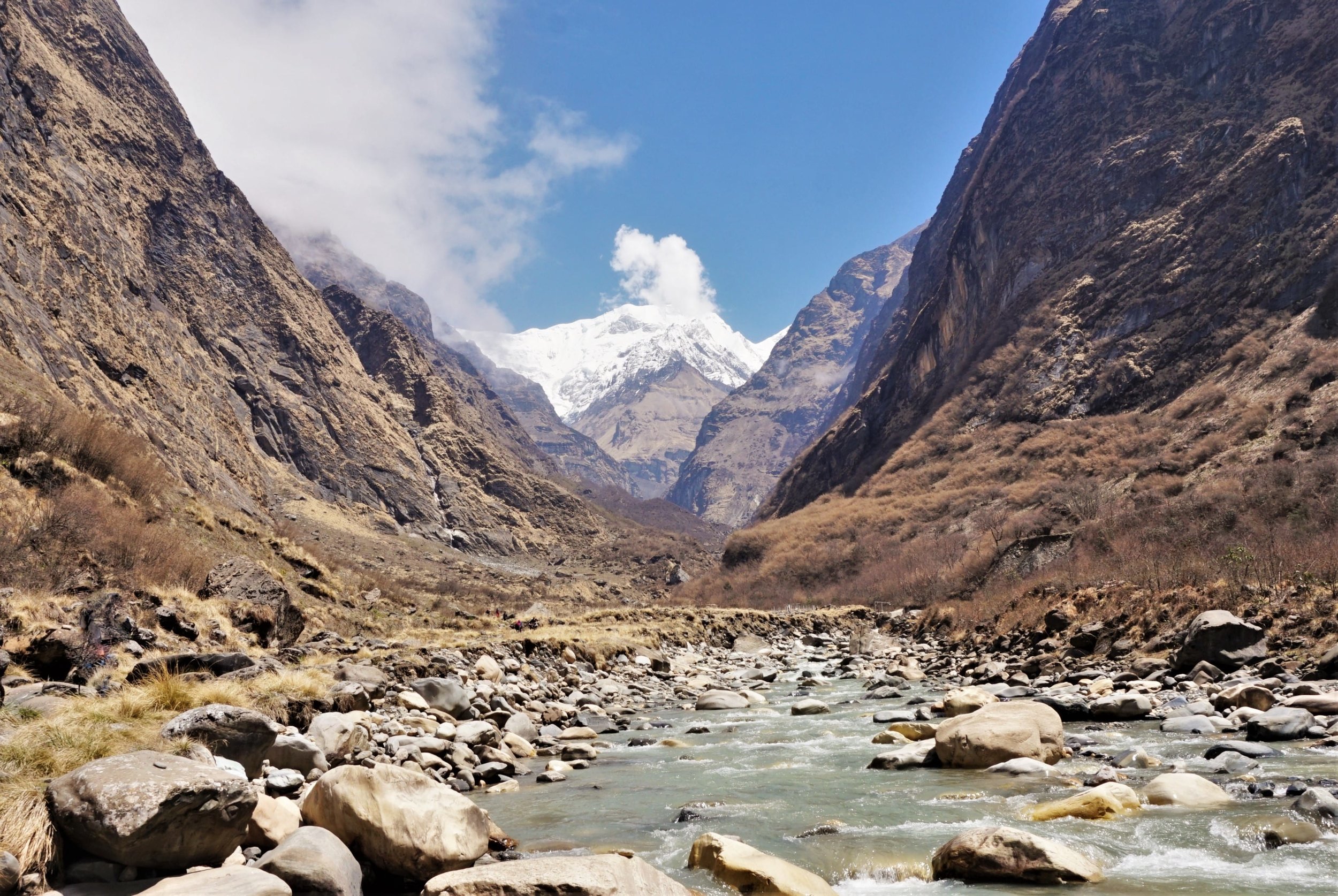
The trail follows Langtang Khola River from start to finish. You walk upstream basically. The river stays your companion for days. The path gains altitude gradually through different vegetation zones. Subtropical forests at the bottom. Alpine meadows at the top. The transformation happens within four or five walking days.
Syabrubesi (1,550m) to Lama Hotel (2,480m)
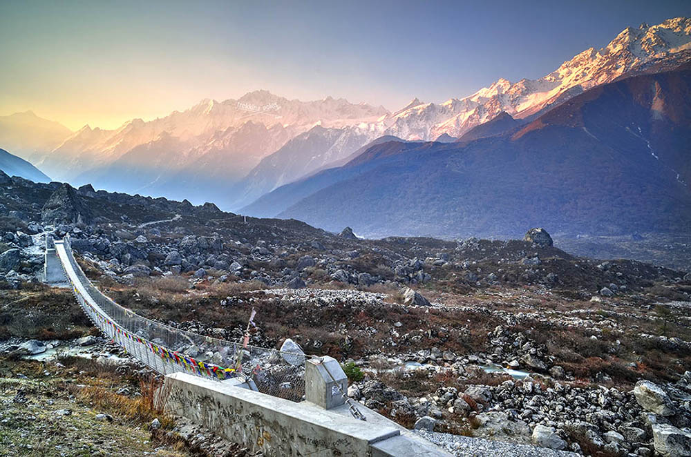
Syabrubesi sits in a narrow valley where two rivers meet. The last proper road ends here. From this point forward, your feet do the work. The trail crosses a suspension bridge right at the start. The river roars below. Your trek officially begins the moment you step off that bridge.
The first few hours climb through farmland and scattered settlements. Bamboo groves appear along the path. The forest here is dense and subtropical. Waterfalls appear throughout this section. Side streams drop from cliffs above. The valley is too narrow. Steep walls block the horizon. You’re walking through a gorge basically. The big views come later.
Lama Hotel isn’t really a hotel. It’s a cluster of teahouses named after a lama who lived here ages ago. Wildlife hides in forests along this stretch. The walking time runs about six to seven hours for most people.
Lama Hotel (2,480m) to Langtang Village (3,430m)
This section is where the valley starts opening up. The forest thins. Views expand. Mountains begin appearing on the horizon. The trail continues following the river. Ghoda Tabela comes about halfway.
The forest transitions noticeably through this section. Oak and rhododendron still dominate lower portions. Somewhere along here the first big mountain view happens. You get the first view of Langtang Lirung. White summit against blue sky. The 7,227-meter giant announcing itself.
The trail condition on this section is generally good. Well-maintained path. Clear markings. Some rocky stretches require attention. The views expand dramatically. To the north? Langtang Lirung. To the east? Gangchempo, followed by a bunch of other giants of the Himalayas.
Langtang Village (3,430m) to Kyanjin Gompa (3,870m)
This is the shortest waking day of the trek. But the altitude gain matters. Your body is adjusting. Leaving Langtang Village, the trail crosses open meadows. Yak pastures and Kharkas stretch on both sides. The forest is basically gone now. The Alpine zone has arrived. The landscape looks different. Bigger somehow. More exposed.
Langtang Lirung gets closer with every step. The mountain fills the northern horizon completely now. Mundu appears about halfway. A small settlement with a few teahouses. Some trekkers stop for lunch here. Others push through to Kyanjin. The rock formation gets more dramatic through this section with lots of cave faces.
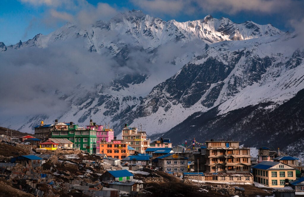
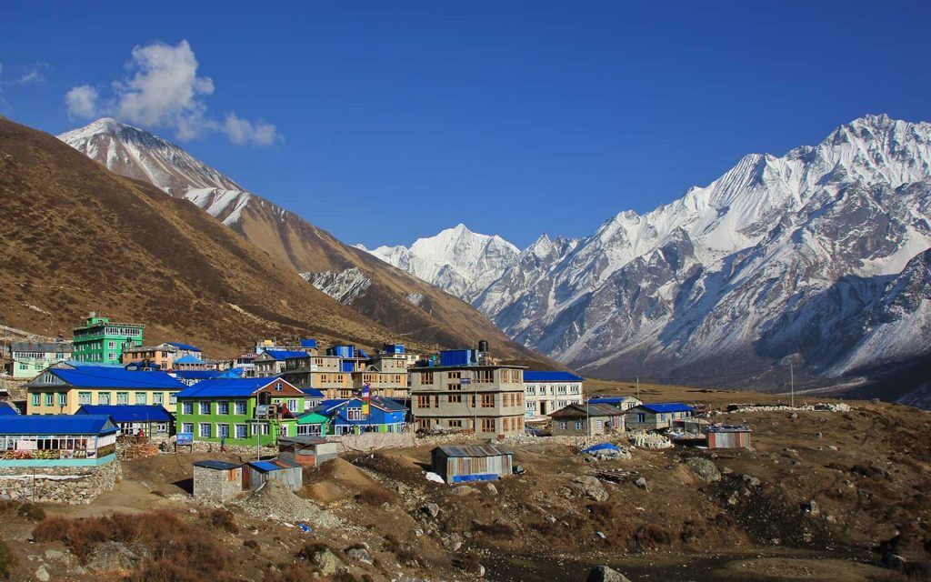
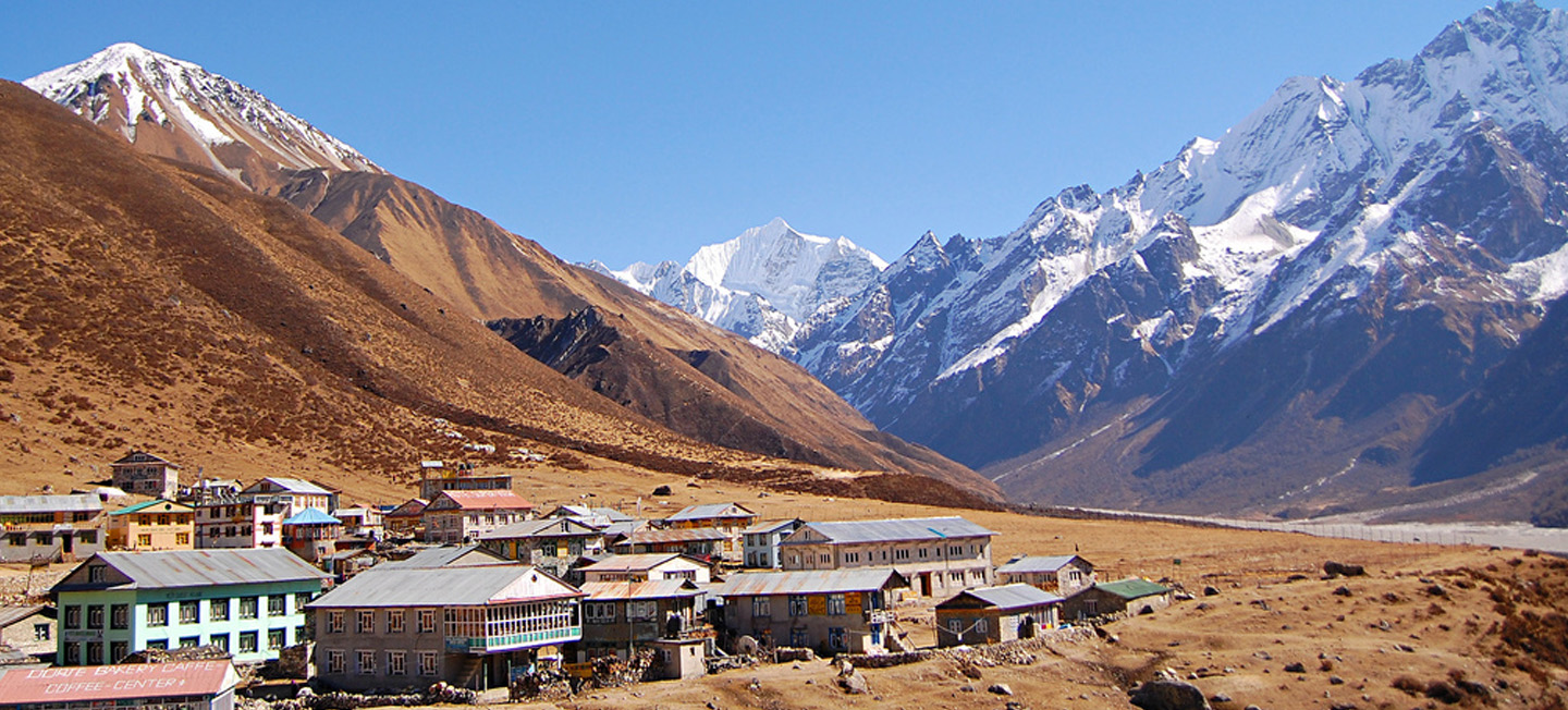
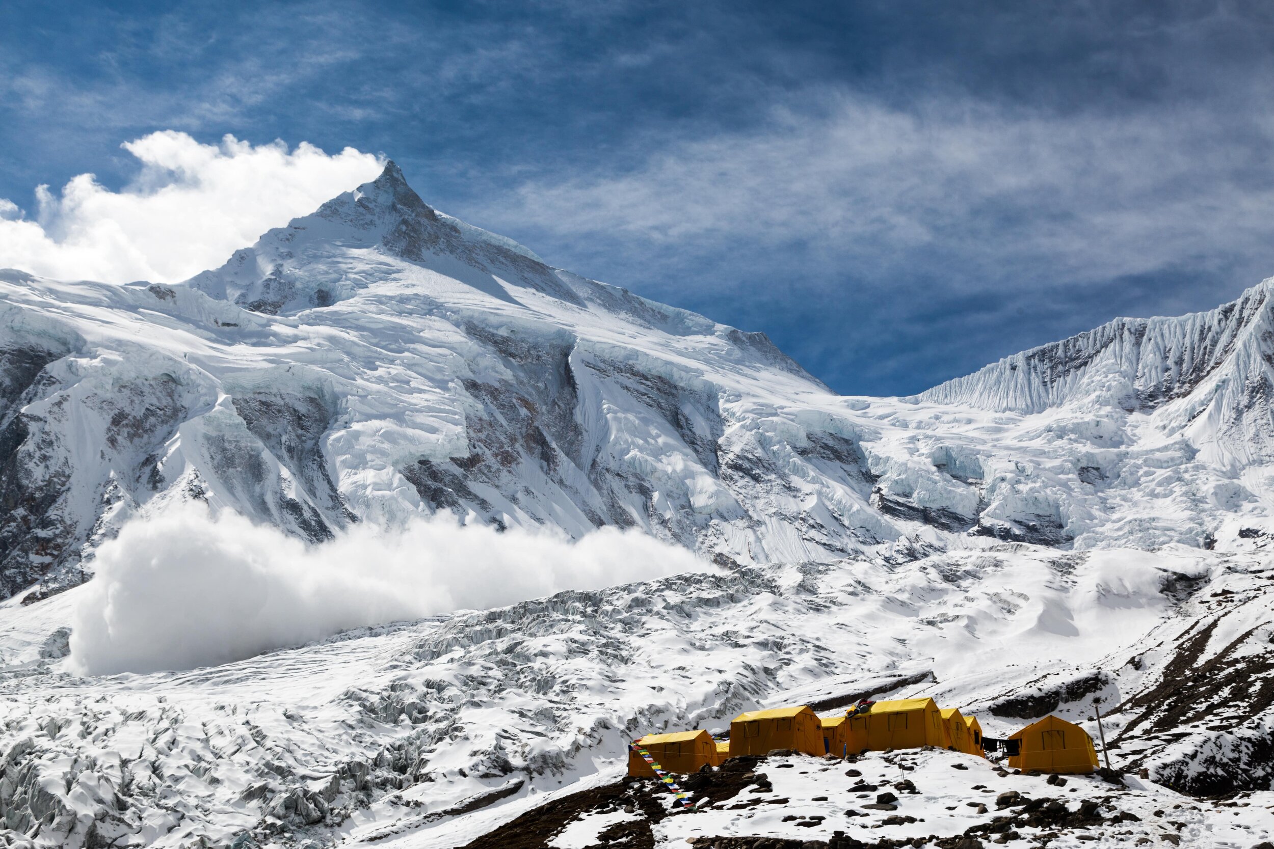
Kyanjin Gompa sits at the upper end of the main valley, with a perfect backdrop of the Langtang Himalayas. There is a gompa, small but spiritually significant. The cheese factory is a quirky highlight. Operating since the 1950s, when Swiss development workers set it up. Local women make yak and cow cheese using traditional methods.
Mountain views from Kyanjin are already spectacular. The glacier system is visible from here. Langtang Glacier, Lirung Glacier, and others feed into the valley. Langtang Lirung towers directly above. Gangchempo stands sharp to the east. Langshisa Ri closes off the valley head. Yala Peak sits north.
Kyanjin Gompa (3,870m) to Tserko Ri (5,033m)
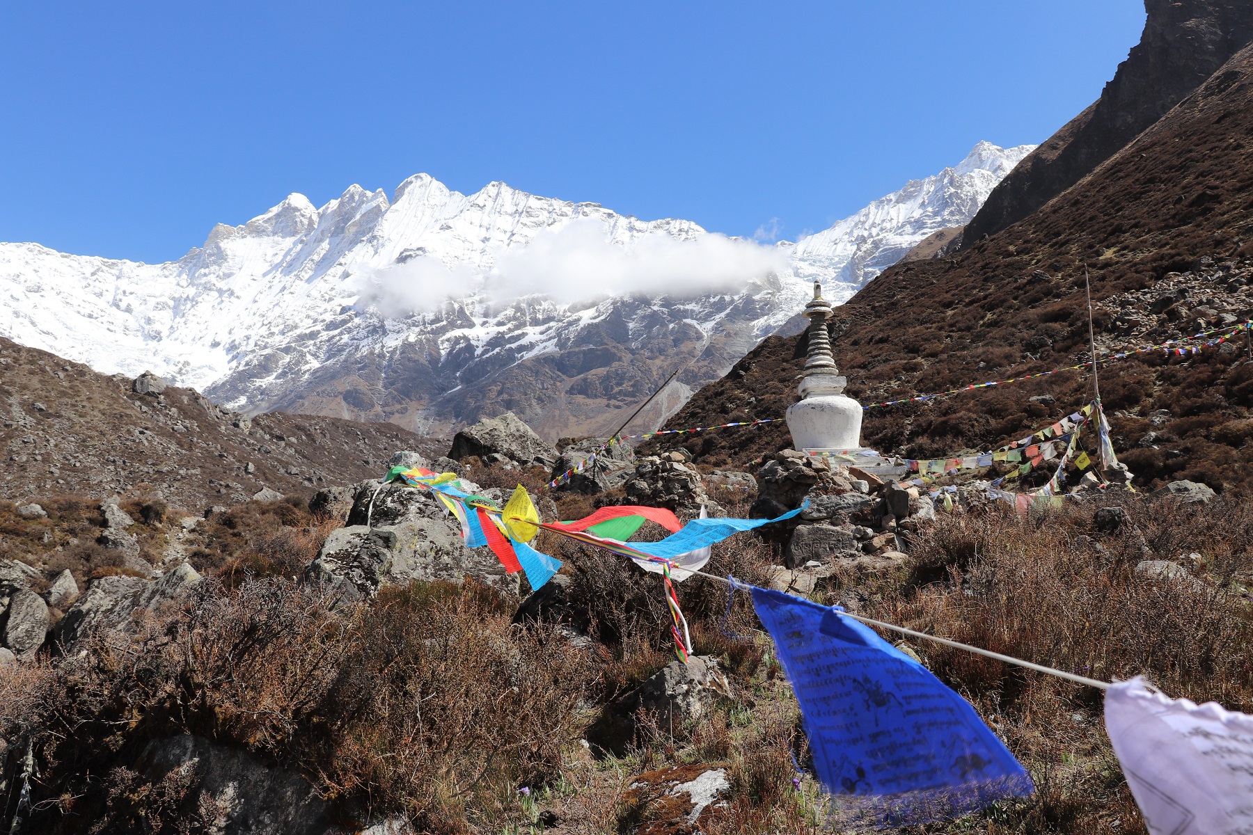
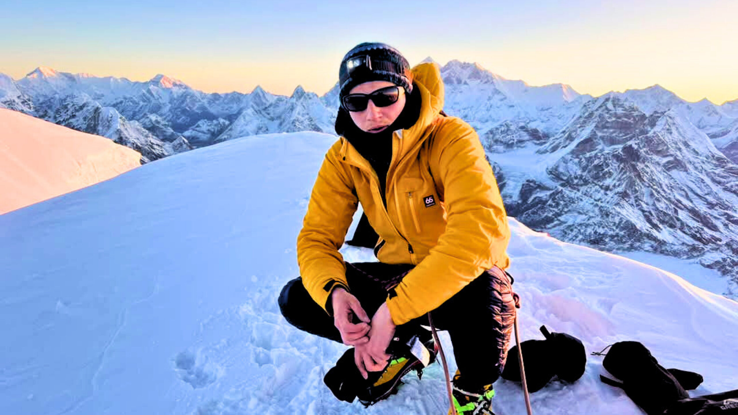
It’s your big panorama day. The payoff for everything before. The 360-degree panorama that makes Langtang famous. The climb starts immediately from Kyanjin. The path heads northeast from the village. Steep from the start. Switchbacks climb grassy slopes. No trees anymore. Just tough alpine grass clinging to thin soil.
The rock here is ancient crystalline stuff. Gneiss and granite mostly. Polished smooth in places by ice that covered everything during glacial periods. As you climb the views keep expanding. Kyanjin Gompa shrinks below. The valley spreads out like a map. The river traces a silver line through brown and green terrain.
Yala Peak appears to the north as you gain height. The summit looks reachable at 5,520 meters.
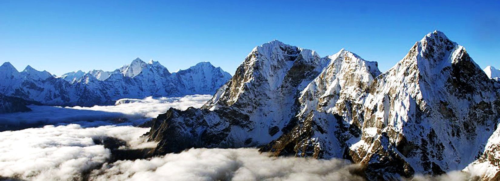
The final push to the Tserko Ri summit crosses rocky terrain. Then you’re on top and the 360-degree views open up. Langtang Lirung dominates the southwest. Turn north and the peaks keep coming. Yala Peak. Kimshung. Naya Kangri. Ranges extending into Tibet.
On exceptional mornings, Shishapangma shows itself. The geology visible from Tserko Ri tells the story of the Himalaya. The only 8,000-meter peak entirely within Tibet. Just visible on the northern horizon. Swing your view west, and more summits appear. Langtang II. Pemthang Karpo Ri. Gurkarpo Ri.
Best time for Langtang Valley Trek
March to May and September to November is considered the best time for Langtang Valley Trek. But, actually there is no such thing as best time to trek. Every season has its own mood and uniqueness. Spring has flowers. Autumn has clarity. Winter has solitude. Even the monsoon has its strange beauty; changing landscapes every hour for those willing to handle rain.
Some people crave crystal visibility where every peak stands sharp against the blue sky. Others prefer quiet trails with no other trekkers around. Some want warmth. Some don’t mind freezing if the views reward the suffering.
Langtang delivers year-round. The valley doesn’t close. Teahouses stay open. The mountains aren’t going anywhere. Your personal preference decides when you should show up. The real question isn’t when it’s best. The question is, what experience do you actually want?
Langtang Valley in Spring (March-May)
- Rhododendron bloom climbs the trail, lighting forests from 2,000 m up toward Langtang Village. Whole hillsides covers in vivid blooms.
- Clear, cold mornings, perfect for clean views of the high Himalayas on a big hike day like Tserko Ri.
- Wildlife is active, high chance of spotting wild animals.
- Local farming activity begins in villages. Families prepare terraced fields for planting season. You witness the rhythm of mountain agriculture happening around you.
- Temperatures feel stable and kind: Kyanjin 10–15°C daytime, often −5 to −8°C at night.
- Trails feel lively but less crowded.
Langtang Valley in Autumn (Sep-Nov)
- The driest, most stable window for the Langtang Valley Trek, with stable weather patterns
- Visibility of the high Himalayas reaches maximum clarity in September to November.
- Harvest season in lower villages, fresh apples, seabuck thorn, local honey, etc. You can engage and experience the local lifestyle and harvesting in a local style.
- Post-monsoon trails are clean, with fewer dusty sections and minimal mud.
- Festivals (Dashain, Tihar) may align with your trek if you make timing right. you can be part of high altitude Himalayan festival.
Langtang Valley in Winter
- Quiet trails and hushed villages create a calm rhythm.
- Fresh snow outlines ridges for dramatic, high‑contrast scenes.
- The trail turns into a snow wonderland, with the Himalayas in its fullest form.
- Solitude and high frequency of energy takes over the valley.
- You can immerse deeply in ancient Himalayan culture, as there will be very less trekkers.
Langtang Valley in Monsoon
- Changing landscapes every hour.
- The trail is empty and less crowded.
- Cloud drama rolls over peaks, no any other season can provide this mood of Langtang.
- Warm temperature and greenery everywhere. The valley turns lush in ways dry seasons never show.
- Fewer people means more authentic interactions. You can engage in traditional Himalayan culture deeply.
Accommodation- Langtang Valley Trek
You will stay in a local Tamang tea house during the Langtang Valley Trek. These teahouses have been in operation, owned and operated by Tamang families throughout generations. Same bloodlines serving trekkers since the trail first opened to foreigners decades ago. These teahouse reflects their culture and tradition. The Tamang Buddhist culture shows everywhere inside. Staying in these teahouses means participating briefly in something old and ancient Himalayan culture.
The energy inside these lodges feels different. It is how real, raw and authentic Himalayan teahouses must be. Most of the windows of the teahouse open up to mystical views of the Himalayas. The 2015 earthquake flattened most original lodges in the upper valley. Families lost their centuries-old home. The teahouse where you stay on the trail was rebuilt. The new structures blend old and new in interesting ways. Stone walls like ancestors built. Rooms are slightly more spacious. Wooden beams carved in traditional Tamang patterns, overall with stronger foundations. better materials, but the traditional soul remains.
Staying here means stepping into the Tamang Buddhist culture directly. You immerse into local Himalayan culture. Rooms are small but can lead to a cozy, warm feel. While the blankets are plenty warm, it’s strongly recommended you bring sleeping bags. At the dining room, everyone huddles around the metal stoves that are heating up. It’s comfortable, honest, and very much the Himalaya. You can get traditional Himalayan foods like Yarshagumba, Tsampa, Thenduk, Sea Buck juice, Yak butter tea, Tongba, Sherpa stew to classic Dal Bhat to western foods like sandwiches, burgers etc.
Wi-Fi, Network, and others in Langtang Valley Trek
Wi-Fi exists in most of the teahouses up to Kyanjin Gompa, but it slows with altitude and weather. Power is mostly solar above the lower villages. No grid electricity reaches these higher settlements. Good weather means decent charging. Overcast days mean limited power for everyone here.
Phone networks work poorly. NTC catches the signal in a few spots. Ncell barely functions. Langtang Village sometimes connects. Some rooms now have a wall socket, but charging is often done in the dining room; outlets are shared and time-limited. We highly recommend you to bring a high-capacity power bank and your own cables.
No ATMs exist anywhere on this trek. Carry all in cash you’ll need. Hot showers exist, but not how you imagine. Someone heats water over a fire. Brings it in buckets. You pour it over yourself with a small jug. The bucket method works. We strictly recommend not taking a bath or a hot shower at high altitudes. Charging device, boiling hot water and Wi-Fi costs an extra few hundred Nepali rupees (300-600rs) at some teahouses higher up, about 2-6 USD.
Difficulty of Langtang Valley Trek
Langtang Valley Trek is ranked as an easy to moderate trek. It is famous as beginner beginner-friendly trek with a smart plan. The highest sleep is around 3,870 m at Kyanjin Gompa. The maximum elevation you will gain is on the legendary hike to Tserko Ri (4,984 m) with 360-degree views of more than 19 Himalayan peaks.
It’s not a physical challenge that makes the Langtang trek difficult; it’s the high altitude. The trails don’t demand crazy fitness or technical climbing skills. No ropes. No ice axes. No vertical scrambling that makes your palms sweat. Just walking. The trail itself goes easy on your body. Gradual climbs. Reasonable daily distances.
The mountains don’t care if you are a professional or a first-time trekker. Professional in the Himalayas are those who respect the rules of the mountains. Mountains respect those who respect it.
With proper acclimation, a slow pace, the right team, porter to carry your weight (25kg max), hydrating properly, and right preparation, the Langtang valley trek is doable and easy.
Can beginners complete the Langtang Valley Trek?
People use Langtang as their first Himalayan trek experience. The views deliver that dramatic Himalayan scale that everyone comes to Nepal. The Langtang Village trek doesn’t require fancy skills or technical knowledge.
I have seen many trekkers, who have never hiked in their entire lives, completing the Langtang Valley trek easily. This trek doesn’t require any hiking background. Beginners with the right preparation, good fitness level can easily complete this trek.
Stick to mountain rules: sleep low, walk high; acclimatize properly; hydrate often, snack regularly, stay fit, and let your guide set an easy rhythm. Do that, and most first-timers and beginners reach Kyanjin easily.
Health & Safety Tips for Langtang Trek
- Start early. Be on the trail by sunrise and aim to top out side hikes (Kyanjin Ri, Tserko Ri) before wind and cloud build.
- Respect altitude. Kyanjin sits at 3,870 m, and Tserko Ri hits 5,033 m; if a headache worsens at rest or you feel dizzy, go lower.
- Bring blister treatment stuff like moleskin and bandages, since blisters ruin more treks than altitude sickness ever does.
- Footing first. Choose boots with grip and trekking poles for the long descents; microspikes help on icy mornings in winter/spring.
- Learn the signs of frostbite on fingers and toes during winter treks since early detection prevents the really bad outcomes.
- Respect the altitude and its rules.
- Carry your regular medications in double amounts because running out of important pills when the nearest pharmacy is days away.
- Acclimatize well and properly.
- Trust your guide. Follow your guide’s advice.
- Treat every drop. Filter or UV your water and carry backup tablets for busy days.
- Get travel insurance that specifically covers trekking above 5,000 meters because helicopter evacuation costs thousands, your regular policy won’t pay.
- Pace beats power. Short steps, steady breathing, no racing, don’t chase someone else’s rhythm.
- Hydrate like it matters. Target 3–4 liters a day up high and add electrolytes; hot tea counts.
- Layer well and properly. Wicking base, warm mid, wind/water shell, and a real puffy for cold evenings.
- Keep rain gear in your daypack, not your duffel, because afternoon weather changes happen within minutes up here.
- Step aside for yak and mule trains by moving to the uphill side of the trail because getting bumped off a narrow path by a loaded yak actually happens.
- Navigate smart. Offline maps on your phone, a small paper map for the table, and a headlamp in the top pocket.
- Even though the room and blankets are warm, bring your own high quality sleeping bags.
- Sleep warm at night with proper layers because your body recovers better when not fighting cold and good rest helps altitude adjustment.
- Sleep low, hike higher.
- Don’t push through meals even when appetite disappears at altitude because your body burns crazy calories up there and skipping food leads to bonking hard.
- Eat hot, simple fuel. Dal bhat, thukpa, potatoes, eggs, and small snacks every 60–90 minutes stave off bonking. Eat more traditional Himalayan foods, because it is healthy and made to tackle high altitude.
- Leave your ego at the trailhead since pushing through serious symptoms to reach a viewpoint is genuinely stupid behavior that may arise worse condition.
- Lighten the load if needed. A porter turns a heavy haul into a steady, warmer, safer walk.
- Avoid drinking lots of coffee in high altitudes, because you may not get proper sleep and you will be confused whether if it is because of altitude or coffee.
Permits for the Langtang Valley trek
We need certain permits and documents to enter this protected area of Langtang.
- Langtang National Park entry permit.
- Trekker’s Information Management System (TIMS) card.
Documents for Langtang Valley Trek
- Original Passport with valid Nepal visa.
- Photocopy of passport/visa
- Travel insurance documents
- Emergency contact number.